Wednesday, December 5, 2012

Hiking Boulder Garden Loop, Mt. Si


The Boulder Garden Loop is a nice loop hike on the west side of Mt. Si that starts at the Little Si trailhead.  It features interesting boulders, moss, grassy lookouts, and a well-maintained trail.  It is moderate in difficulty at 900 vertical feet of elevation gain and around 4 miles round trip.  The following shows the route marked in yellow:

The trip starts as though hiking to Little Si, taking a right turn up the Old Mt. Si trail, climing 900 feet to where the Boulder Garden Loop splits off of the Old Mt. Si trail, then looping back to the Little Si trail.

A hike of the Boulder Garden loop can be combined with a climb of Little Si to double the elevation gain, or combined with a climb of Mt. Si to triple the elevation gain.

Directions to Trailhead: Take I-90 to exit 32, head north, then left on North Bend Way. In 0.3 miles you'll see the turnoff for Mount Si Road on the right. Follow the road 0.6 miles over the bridge, past the overflow parking lot to the Little Si trailhead parking lot on the left.  A Discover Pass is required at the trailhead.


Sunday, November 11, 2012

Scrambling Mt. Teneriffe, Serendipity Ridge Route

We scrambled Mt. Teneriffe on Nov., 11, 2012 by the Serendipity Ridge route.  The following map snippet shows the approximate route:

The route we followed was:

  • Left trailhead, 7:40 am, elevation 950'.
  • Arrived at smaller logging road right turn, 7:55am, elevation 1150'.
  • Arrived at Teneriffe Falls trail junction, 8:20, elevation 1500'
  • Arrived at Teneriffe Falls, 9:00, elevation 2450'.
  • Gained Serendipity Ridge, 9:30, elevation 2700'.
  • Arrived at summit, 10:50, elevation 4797'.  Time to summit 3:10.  Spent 15 minutes on summit.
  • Arrived at trailhead, 1:40.  Time to descend 2:40.
  • Total trip time 6:00.

The conditions were below freezing for the entire trip, with temperature in mid 20's on the summit.  There was light dusting of snow starting at around 2,700'.  The last 200 vertical feet below the summit involved scrambling on rock that was coated with a thick coating of ice, making the rock treacherous.  We wore microspikes which helped with the ice.


Here is a link to the weather forecast near the trailhead (North Bend):

Here is a link to the weather forecast near the summit (Mt. Si summit):


Driving Directions:
From I-90, take exit 32 (436th Avenue SE). Turn left (north) over the freeway and drive 0.5 miles to SE North Bend Way. Turn left (west), and in 0.25 mile turn right (north) on SE Mt Si Road. In approximately 3.5 miles (one mile past the Mt Si trailhead), you will reach a small parking area on the left (directly across from 480th Ave) known as the school bus turnaround.  A Discover Pass is required.

Sunday, October 14, 2012

Scrambling Faye Peak, Mount Pleasant, and Hessong Rock

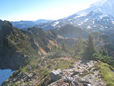
A traverse of Faye Peak, Mount Pleasant, and Hessong Rock on 10/7/2012.  The route was: start at Mowich Lake, boot path up to Knaapsack Pass, traverse on the northwest side of the ridge to to Faye Peak, traverse on the southeast side of the ridge to Mount Pleasant, traverse the ridge to Hessong Rock, following the boot path along the northwest side to steep heather on the southwest side leading to the summit.  The descent involved returning to the col between Hessong and Pleasant, then descending to Spray Park and returning by the trail by Spray Falls and Eagle Roost Camp.  Total elevation gain of around 3,000 vertical feet and car to car time of around 6 hours.

The view of Knaapsack Pass:


Looking towards Faye Peak from Knaapsack Pass:
 

Looking along the ridge to Faye Peak summit:
 
The view of Mount Pleasant from the summit of Faye Peak:
 
The view of Hessong Rock from Faye Peak:
 

The view of First Mother Mountain from Faye Peak:
 
Looking back at the traverse from Faye Peak to Mount Pleasant:
 
Hessong Rock from Mount Pleasant:
 
Looking down at Seattle Park from Mount Pleasant: 
 
Looking east from the summit of Hessong Rock:
 
Posted by Picasa

Thursday, September 27, 2012

Scrambling Del Campo Peak, Washington

A scramble of Gothic Peak on 9/22/2012 and Del Campo Peak on 9/23/2012.  We left from Barlow Pass and hiked the approach trail to Foggy Lake, an approach of about 3,000 vertical feet in around 3 miles.  We set up camp in thick cold fog.  From the camp we then scrambled Gothic Peak.  Gothic is just over a thousand vertical feet from foggy lake and took about one hour 15 minutes from the lake and about one hour for the descent.  Much of the climb was over very rough talus, difficult going, until we gained the southeast ridge just below the summit.  It would probably have been better to gain the ridge directly above the lake.  From the ridge a 100 foot rock scramble with moderate exposure, more difficult than expected, led to the summit.

Over night the clouds lifted and the next morning we left for Del Campo at 6:30 am.  Del Campo is north-northwest of foggy lake and is about 1500 vertical feet above the lake.  We rounded the lake on the east side and climbed a nice climbers' boot path up the ridge just north of the lake.  At the end of the boot path we scrambled over loose talus boulders to the cliffs of Del Campo.  We headed up a gully visible from the lake as a notch east of the summit.  Three-fourths of the way up the gully, we accessed the climbing route on a narrow shelf.  The scrambling route involved somewhat difficult rock scrambling with some exposure.  There are very good handholds, jugs, throughout the route.  But much of the rock is fractured, making most handholds at least somewhat suspect.  At least 500 vertical feet of rock scrambling leads to the summit.  Downclimbing involved a combination of face-in and face-out descending of the same route.  We were back at camp at 10:30am making four hours round trip.

The approach trail:

View from the campsite at foggy lake:

Del Campo from Foggy Lake:

Gothic Peak from Foggy Lake, the leftmost peak in the background:

The scrambling route up Del Campo:

Del Campo in the early morning:

The rock scrambling on Del Campo:


Saturday, September 15, 2012

Hiking Butte Camp, Mt. St. Helens

A nice, overnight backpacking trip to Butte Camp, Mt. St. Helens on Sept. 9th, 2012.  The trailhead is at Red Rock Pass on Forest Road 81 in Mt. St. Helens National Monument at elevation of 3,300 feet. and the camp is at around 4,000 feet.  To reach the trailhead from Cougar, head east on forest road 90, take a left onto forest road 83, and then left on forest road 81.

The trip to Butte Camp is around 6 miles round trip to the camp.  Continuing further up above treeline to the Loowit trail at 4,800 feet, a nice side trip from camp, adds another 2 miles round trip and an additional 800 vertical feet of gain for a total of around 8 miles round trip.

Mt. St. Helens can also be summited via the Butte Camp approach, either by linking up with monitor ridge which is clearly visible just to the east, or heading directly up, working around the many loose gullies.

An incredible open lava flow just a few yards from the trailhead.

A view of the summit from near the trailhead:

A view of the butte in the distance:

The nice meadow with a tiny winding creek at Butte Camp:

 The creek at Butte Camp:

 Hiking above the camp near treeline:

The view from near treeline:

Treeline:

Near Loowit Trail:

Looking back down at the Butte:

Looking back down from far above Loowit trail:


Friday, September 14, 2012

Climbing Eldorado Peak

A climb of Eldorado Peak via the Inspiration Glacier on July 18, 2010.  A single day trip, leaving at 5am and returning at 7pm for round trip time of 14 hours.

Looking up towards Cascade Pass:


Johannesburg Peak from the Eldorado Approach:
 
Looking towards Cascade Pass at gleaming glaciers:
 
Long boulder field on the approach:
 
A look at the route up the glacier and a view of the summit:

Glacier Peak:
 
Looking across the glacier fields:
 
Looking back at our route from hammered ridge:
 
Approaching the summit:
 
A close up view of the summit:
 
Beautiful fields of white near the summit:
 
The summit ridge:
 
Looking at bergshrunds along the top of the glacier:
 
The notorious knife-edge summit ridge:

Looking back down at a small tarn far below:
 
The knife-edge summit ridge.  Running belays were used.
 
The view from the summit:
 
On the summit:
 
North cascades from the summit:
 
Posted by Picasa